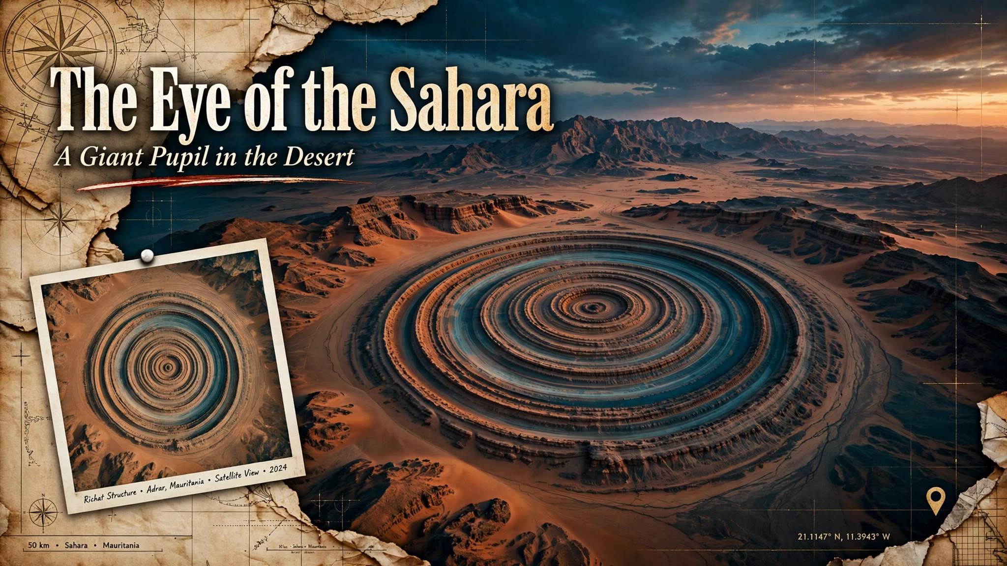
Mauritania, Africa. In this land ruled by burning sand and dry wind, look down from tens of thousands of meters up in space, and you will notice a giant “eye” opened in the surface of the earth, gazing back at you. It is one of the most magnificent geometric patterns on Earth — commonly called the “Eye of the Sahara,” and known to science as the Richat Structure.
Some 40 kilometers across. Its concentric circles are so perfect that, in the age before humankind had a viewpoint from space, the people who walked the ground had no way of knowing its full form. When, in 1965, Gemini 4 astronauts James McDivitt and Ed White first photographed this “pupil” from space, it is said they fell under the illusion that the Earth itself was staring back at them.
Is this ring — so vast, so orderly — merely a product of chance? Or is it the remnant of some grand design left behind by a lost ancient civilization? This eye has been called the “Pupil of the Titan,” and its uncanny resonances with the legend of Atlantis have long been told. This time, taking up that record, we trace the answer of geology and the romance that remains unsolved, keeping the two apart.
Let us say this first. This eye is not a meteorite crater. It was once thought to be one, but investigation has produced a different answer. Yet that answer did not erase the mystery. If anything, it changed the mystery’s shape.
The eye has another name as well. It is sometimes called the “Eye of Africa,” and among astronauts it has long been a familiar landmark over the Sahara. In recent years, new photographs from the International Space Station have been released, drawing the world’s attention once again. For more than half a century, humankind has gone on gazing into this eye.
- Observing the “Blue Pupil” on Google Maps
- 1965 — The Eye Seen from Space for the First Time
- Anatomy of the Pupil — A Dome Raised, and 100 Million Years of Erosion
- The Human Ages the Eye Has Witnessed
- An Astonishing Resonance with the Legend of Atlantis
- Our Reading — A Cross-Section of the Living Earth
- In the Area: Recommended Sights and Activities Around the Adrar
- What to Eat: Food to Enjoy Locally
- Getting There: From Nouakchott — The Road to the Far Edge of the Sahara
- Fragments Assembled
- Sources & Further Reading
Observing the “Blue Pupil” on Google Maps
Open the satellite view at the observation point. When you open it, zoom out first. This eye is so enormous that, zoomed in, you cannot take in its whole form. Pull back, and within the reddish-brown desert, pale blue-white concentric circles rise into view. The pale glow at the center is hard quartzite reflecting the sunlight, and its contrast with the iron-bearing red desert around it makes it look like the iris of a pupil. Zoom in and out, and enjoy the journey of tracing the 40-kilometer ring.
One thing to keep in mind here: when we look at this eye as “a single mystery,” we must not cut it off from the scale of time. Around the eye, strata hundreds of millions of years old lie exposed in concentric rings, and the whole functions as a cross-section of the interior structure of the planet. Before cutting the eye out alone and mystifying it, we first need to know over how many hundreds of millions of years this land was made.
1965 — The Eye Seen from Space for the First Time
The Richat Structure drew the world’s attention with the arrival of the space age. In June 1965, James McDivitt and Ed White — the astronaut who performed the first American spacewalk — aboard NASA’s Gemini 4, discovered a giant ring over the Sahara as part of their Earth observations and captured it on film. The image recorded on that film was nothing less than an “eye” opened in the surface of the Earth. NASA is said to have asked its astronauts to watch for “large circular features” that might be ancient impact sites.
In fact, the structure had been known on maps even before that. French geographers surveyed it in the 1930s and 1940s, and in 1948 Jacques Richard-Mollard described it scientifically, naming it the “Buttonhole of Richat.” During the Second World War, it is said to have served as a landmark for pilots flying over the Sahara. But the first time humankind laid eyes on its “whole picture” was in 1965, when we gained the viewpoint from space.
Since then, this eye has become a landmark for astronauts. Crews of the International Space Station have photographed it again and again, and in recent years new satellite images have been released to fresh acclaim. What cannot be seen from the ground can be seen from space — the Richat Structure is a place that embodies that paradox.
The frames of the film they shot were given the archive number “GEM04-16-34670” and remain in NASA’s records. A single photograph turned an unnamed desert landform into a world landmark — a textbook example of the “discoveries” that space development brought.
Anatomy of the Pupil — A Dome Raised, and 100 Million Years of Erosion
So what is this eye, really? The current answer of geology runs like this. About 100 million years ago, magma beneath the ground pushed the surface up into a dome. Over the long ages that followed, wind and water shaved away the top, and because hard rock and soft rock erode at different rates, concentric strata came to be exposed. It is, so to speak, a “cross-section” of the interior structure of the Earth, laid bare on a scale of 40 kilometers.
It was once thought to be the scar of a meteorite impact. In 1969, geologists published a paper concluding that it was “not an impact crater,” showing that no evidence of impact — shocked quartz and the like — could be found. Research in 2005 cemented the current consensus: formation by domal uplift and differential erosion. In 2022, it was also named one of the “First 100 Geological Heritage Sites” by the International Union of Geosciences (IUGS).
These strata also carry the memory of humankind. Around the structure, Acheulean stone tools of the Paleolithic and artifacts of the Middle Stone Age have been found, and we know that during the African Humid Period, some 15,000 to 8,000 years ago, this land had water and greenery. The eye is watching the time of the Earth and the time of humankind at once.
Look closely inside the structure, and evidence of magmatic activity turns up: volcanic rocks, rocks altered by hydrothermal fluids, breccia at the center. The 2005 study by Matton and colleagues positioned this structure as a “concentric complex of alkaline magma.” Layers of hard quartzite resisted erosion and became ring-shaped ridges, while softer layers were carved into valleys — and that repetition drew the 40-kilometer pupil.
Some 40 kilometers in diameter. It lies on the Adrar Plateau of Mauritania, at the northwestern edge of the Taoudeni Basin.
Doming by magma below ground, and long-term differential erosion. It is not a meteorite impact scar.
At the center, rocks some 600 million years old are also exposed. It was formed long, long before humankind.
Named in 2022 as one of the “First 100 Geological Heritage Sites” of the International Union of Geosciences (IUGS). Paleolithic stone tools have been excavated in the surrounding area.
Learning what something is, and the disappearance of the strange impression it gives, are not the same thing. Before a ring made by 100 million years of time, the answer of geology is itself a kind of romance.
The Human Ages the Eye Has Witnessed
This eye has witnessed not only the time of the Earth, but the time of humankind as well. Around the structure, Acheulean stone tools of the Paleolithic have been excavated in large numbers, and artifacts of the Middle Stone Age have also been found. During the African Humid Period, some 15,000 to 8,000 years ago, the Sahara was not the desert it is today, but a land of water and greenery. The record of the sediments tells that story.
In other words, people once lived at the shore of this pupil. There were people who made stone tools, sought water, and walked a green land. Did they, too, look up at the night sky and live upon the ringed earth? Beyond the answer of geology, the story of humankind lies layered over it.
An Astonishing Resonance with the Legend of Atlantis
Geology is not the only reason the Richat Structure grips the imagination of the world and will not let go. In recent years, a theory has spread explosively across the internet — that this very place is Atlantis, the legendary lost city described by Plato.
One of the sparks for the spread of this theory was a speculative video posted on an overseas video site. Matching concentric circles, near-matching dimensions, the colors of the stone — the video lined up its visual “evidence,” spread explosively, and the Richat Structure suddenly became known as a “leading candidate for Atlantis.” The internet had given an ancient legend a new stage.
According to Plato’s Timaeus and Critias (around 360 BCE), Atlantis was made of “concentric rings of land and water,” and the diameter of its outermost ring is given as 127 stadia (about 23.5 kilometers). The size of the inner rings of the Richat Structure is startlingly close to that description. Plato also wrote that the land produced “red, white, and black stone,” and rocks of similar colors are found at Richat as well. Even the description of “mountains to the north, and a plain opening to the sea in the south” can be laid over the Sahara of the African Humid Period — or so the supporters of the theory argue.
The experts, on the other hand, are severe. Atlantis is supposed to have been an island that sank into the sea “beyond the Pillars of Heracles (the Strait of Gibraltar),” yet Richat lies in an inland desert at an elevation of about 400 meters. No ruins of a city, no traces of canals have been found. To begin with, many classical scholars consider Atlantis a “fable” that Plato invented. Geologically, too, this structure was formed long before humankind, and there is no trace of a city ever built upon it.
According to Plato, Atlantis “sank into the sea in a single day and night.” Violent earthquakes and floods swallowed the island, the Timaeus records. There is no trace of that at the Richat Structure. But geology does admit that the Sahara was once a green and fertile land. Whether what was lost was an “island” or the “green” — depending on how the question is framed, the scenery changes.
But let us stop here and think. Scientific refutation has not lessened this theory’s charm in the slightest. The beauty of the rings cannot help but summon the romance of a lost civilization — and is that working of the imagination not itself proof of the power this coordinate holds? Savor the rumor as a rumor, the romance as a romance. That is the way of Coordinates and Fragments.
Our Reading — A Cross-Section of the Living Earth
What we are looking at is the trace of a “breath” that the planet Earth took over hundreds of millions of years. Magma pushed the surface up, the wind carved it away, and only the hard rock remained, as rings.
The true strangeness of this eye lies in its symmetry. A perfect ring maintained across 40 kilometers is rare in the natural world. Strata rich in quartz reflect the sunlight and form the pale, shining pupil. Keeping a silence of hundreds of millions of years, gazing up at the sky without cease — how does this eye see the civilization of us short-lived humans?
Atlantis or not, the value of this place does not waver. Here, the memory of the Earth lies exposed — a cross-section of the planet, so to speak. Astronauts use it as a landmark, geologists choose it as heritage, dreamers lay a lost city over it — a single ring harbors three stories at once.
Humankind once looked up at the sky and sought meaning in the arrangement of the stars. Now satellites look down on the ground, and as if answering that gaze, the earth opens an eye. The circulation of seeing and being seen — at its center lies this 40-kilometer pupil.
The desert wind is carving this pupil away, little by little, and one day will return it to the flat sand. But at this very moment, there it is: the Earth, quietly and without blinking, gazing back into the depths of space.
An eye does not exist “in order to be seen.” It is simply there. When humankind rose into space and first beheld its whole form, we moved over to the side of “the seen.” The experience of being gazed back at by a giant pupil — it reverses the positions of observer and observed. The true mystery of this coordinate may lie neither in geology nor in legend, but in that reversal.
In the Area: Recommended Sights and Activities Around the Adrar
The Eye of the Sahara can also be visited from the ground, and scattered around it are places that tell the history of the Sahara. For an actual trip, plan around facilities that are open to the public and local guides.
An ancient town that serves as the final base for the Richat Structure. It preserves remains such as a 14th-century mosque, and forms part of the World Heritage site “Ancient Ksour of Ouadane, Chinguetti, Tichitt and Oualata.”
A city of learning, sometimes called the “seventh holy city of Islam.” It is known for its libraries of manuscripts, guarded in family homes for centuries. It is likewise a World Heritage site.
A green paradise made by springs welling up in a gorge and groves of palms. It is cherished as a way station on desert journeys.
A World Heritage site on the Atlantic coast near the capital. On tidal flats where desert and sea meet, migratory birds gather in numbers among the greatest in the world.
These sights and the Richat Structure are connected within the broad region of the Adrar; they are not neighboring facilities within walking distance. Moving through the desert requires a 4WD vehicle and a local guide.
What to Eat: Food to Enjoy Locally
Mauritania is a land where Arab and African food cultures meet. In the intervals of a desert journey, one wants to touch the taste of the land. It is a flavor rooted in daily life, unlike glamorous restaurant cooking.
The staple of North Africa. Grains of pasta steamed with meat and vegetables — indispensable at a table of hospitality.
Rice cooked with seafood and vegetables. In this country facing the Atlantic, fresh seafood enlivens the table.
An ingredient unique to a desert country. Eaten stewed or grilled, it gives travelers strength.
Green tea brewed sweet, with mint added. A symbol of hospitality, served many times a day.
Because hygiene and business conditions change, we do not list specific shop names or business hours. It is best to search for the taste of the land with the guidance of a local guide. And sipping sweet mint tea while waiting for the desert night is not bad either.
Getting There: From Nouakchott — The Road to the Far Edge of the Sahara
The journey to the Eye of the Sahara remains an adventure even today. From the capital, you push into the depths of the desert by four-wheel drive.
From a major international airport in your own country, fly to Nouakchott. Opened in 2016, this is the air gateway of Mauritania, reached via Paris, Casablanca, Istanbul, and other hubs.
About five hours by car northeast from the capital. Atar, the central city of the Adrar Region, becomes the base for desert tours.
From Atar, further east. The World Heritage ancient town of Ouadane is the final base for the Eye of the Sahara.
Charter a four-wheel-drive vehicle from Ouadane and cross some 40 kilometers of trackless desert. Traveling in a convoy of several vehicles, with a trustworthy local guide, is essential.
From the ground, the full form of the rings cannot be seen. Even so, the experience of standing at the center of the 40-kilometer pupil can be had nowhere else. Complete the observation on the way home with Google Maps and Google Earth.
Some regions of Mauritania may be subject to travel restrictions depending on the security situation. Before traveling, always check the overseas travel safety information of your own government, and absolutely avoid entering the desert alone.
Daytime temperatures can exceed 45°C. A vehicle breakdown can quickly become a life-threatening emergency. Secure water, fuel, and a means of communication, and travel in a convoy of several vehicles.
From the capital into the desert, and on to the center of the pupil. Even if the whole form cannot be seen from the ground, you can stand inside the eye. “The place you can reach” and “the scenery you can see” do not coincide — that gap may be exactly the charm of this coordinate.
Fragments Assembled
The true nature of the Eye of the Sahara was neither a meteorite crater nor the city of Atlantis. A cross-section of the Earth, built up by the uplift of magma some 100 million years ago and long erosion — that is the answer the investigation arrives at.
But after learning that answer, open the satellite imagery once more. The pale pupil may still appear to be gazing back at you, even now. A perfect ring lies in the very middle of the desert. Is that fact alone not fantastic enough? Gazing into the pale pupil, you cease to know whether you are the one looking, or the one being looked at.
On the map, the pupil can still be read. Humankind once looked up at the sky and sought meaning in the stars. Now we look down on the ground from space, and as if answering that gaze, the earth opens an eye. Knowing what something is does not mean losing the mystery. It means that the shape of the mystery changes.
Sources & Further Reading
- JAXA Earth Observation Research Center — Sahara’s Eye Watching Space — The record of the first observation from space, by Gemini 4
- NASA Earth Observatory — Richat Structure, Mauritania — An explanation of the Richat Structure
- Wikipedia — Richat Structure — An overview of the geology and formation process
- The Archaeologist — Richat Structure: Eye of Sahara as Atlantis Epicenter — An examination of the Atlantis theory
- Britannica — Richat Structure — An explanation of the Richat Structure
- UNESCO World Heritage Centre — Ancient Ksour of Ouadane, Chinguetti, Tichitt and Oualata — The neighboring World Heritage site