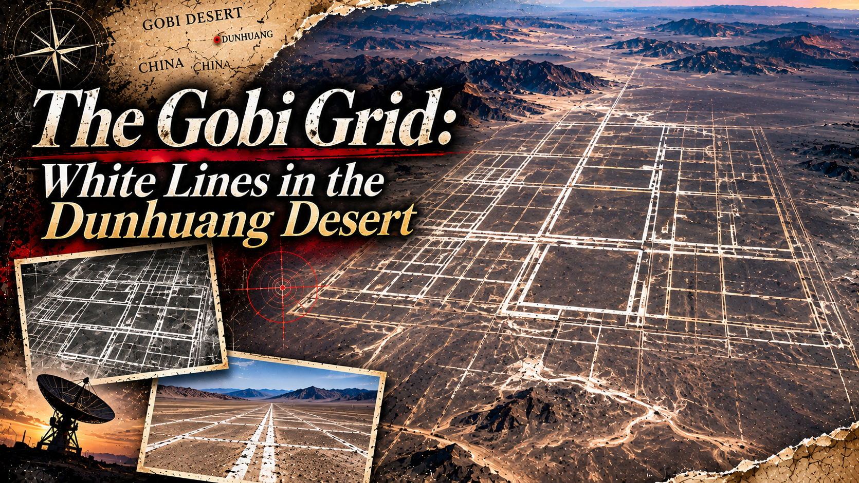
In northwestern China, follow Google Maps across the drylands near Dunhuang in Gansu Province — a wilderness where neither town lights nor field boundaries can be seen — and suddenly, on the surface of the earth, geometric patterns made by human hands appear.
Pale lines cross, bend, and run on as long straight stretches. They look like the blueprint of a labyrinth, or like an enormous electronic circuit. Why would anyone need to draw “lines” so large they can be seen from space, in a desert where no one lives?
In 2011, when structures of this kind drew attention on Google Earth and Google Maps, news organizations and internet users around the world brought their own interpretations: a military exercise ground, calibration targets for reconnaissance satellites, a mock map of a city. There were even theories of a lost civilization, and of a message from aliens.
But dig into it, and real space technology and military history come into view — too substantial to let this be dismissed as a mere “mysterious ground drawing.” In this article, while preserving the unsettling rumors handed down in earlier accounts, we follow the story with what the record can support kept separate from what cannot yet be solved.
- Observing the “White Labyrinth” on Google Maps
- The Setting — Dunhuang, Jiuquan, and the Desert’s Vast Blankness
- 2011: The Giant Patterns That Google Earth Brought to Light
- Record of Rumors: A QR Code for Aliens, a Lost Civilization, a Model City
- Darker Hypotheses Preserved in Earlier Accounts
- What Is It Really? — The Leading Theory: Satellite Calibration Targets
- Calibrating Satellites Over a Desert Is Real Technology in Itself
- Ground Markers for Satellites in America’s Deserts, Too
- How Far Can the Military Exercise Ground Theory Explain It?
- The Words “State Secret” Create Another Labyrinth
- Our Reading — “A Ground Drawing Made to Be Seen”
- Questions That Remain — Who Maintained Them, When, and for What?
- In the Area: Recommended Sights and Activities Around Dunhuang
- What to Eat: Food to Enjoy Locally
- Getting There: From Distant Cities to Dunhuang — Aiming for the Desert’s White Labyrinth
- Fragments Assembled
- Sources & Further Reading
Observing the “White Labyrinth” on Google Maps
Open the satellite view at the observation point carried over from earlier accounts. What you see there is a strange series of lines, different from natural river courses and roads. Because the impression changes with the capture date and scale of the imagery displayed, zoom in and out repeatedly and compare the lines with the surrounding terrain.
What matters here is that the “mysterious patterns in the Gobi Desert” taken up in the 2011 reporting were not in just one place. The sites indicated differ from article to article and image to image, and maze-like grids of straight lines, orderly sets of lines, circular arrangements, and facilities surrounding aircraft-like objects have all been treated as part of the same story.
The observation point this article carries over. The embedded Google Map and the direct links retain the values handed down from earlier accounts.
A different site that outlets such as Live Science introduced in 2011 as a “strange zigzag pattern.” Take care not to mistake it for this article’s observation point.
A site reported in 2011 as a candidate for a different radar-related target. The circular structure with an aircraft-like object at its center is not the same thing as the white zigzag lines.
In other words, if you unconditionally equate “the giant grid you saw online” with “the coordinates in an article,” you risk mixing in the explanation of a different facility. Comparing multiple sites is itself an important act of observation for enjoying this mystery.
The Setting — Dunhuang, Jiuquan, and the Desert’s Vast Blankness
This area has been reported as dryland spreading around Dunhuang and Jiuquan in Gansu Province, northwestern China. Land where sand and gravel stretch out may look monotonous from the ground, but seen from the sky, artificial lines produce a strong contrast.
Dunhuang is a town known for its Silk Road history, but the wider region also holds facilities connected with space development and military activity. In the 2011 reporting, the fact that the area lies near space-related facilities in Jiuquan became material for thinking about what the patterns were for.
However, the geographical existence of military and space facilities and the claim that the structure at this article’s coordinates is administered by a specific military organization are separate matters. We could not confirm any public materials supporting the latter.
2011: The Giant Patterns That Google Earth Brought to Light
The story was taken up in a big way in November 2011. The American ABC News, Wired, Live Science, the Los Angeles Times, Japan’s Netorabo, and others introduced the white lines and strange structures visible on Google Maps.
ABC News mentioned a pattern about 1 mile long and about 3,000 feet wide, and reported that a variety of theories were flying around online. The Los Angeles Times likewise described a representative linear structure as about 0.65 miles wide and about 1.15 miles long. These are rough figures concerning some of the reported subjects, not measurements of the pattern at this article’s coordinates.
What surprised people online was not only the size. Lines whose meaning no one understood existed, in a form meant to be seen from the sky, on land far from human habitation. Google Earth, an everyday tool, suddenly turned a landscape that the public had never been conscious of into a “discovery.”
Record of Rumors: A QR Code for Aliens, a Lost Civilization, a Model City
The rumors surrounding this pattern are not merely later inventions. Trace the reporting of 2011 itself, and you can confirm that genuinely strange interpretations were being introduced at the time.
A Gizmodo piece quoted by ABC News introduced the half-joking speculation that it might be “a QR code for aliens.” The property that the whole picture emerges only when you look down from space is probably what invited that association.
A New Scientist mention introduced by ABC News included conspiratorial reactions wondering whether it might be the trace of an ancient civilization. The artificial geometric shapes probably connected, in people’s minds, with images of ground drawings and ancient ruins.
Live Science also listed, among the speculation of the time, the theory that it might be a military target modeled on the map of an American city. No confirmation that it actually matches a street network can be found.
Images of damaged vehicles and objects resembling aircraft found nearby suggested the possibility of target practice. However, structures at different sites must not be explained as a single facility.
The explanation that these are ground patterns for examining the orientation, image quality, and geometric distortion of cameras in the sky. This is the leading theory that experts later strongly supported.
The reason the alien and ancient-civilization theories attracted people lies in the strangeness of a landscape that seems readable only from the sky. Lines that look as if someone must have drawn them — yet what they are trying to convey is unknown. That eeriness itself was the starting point of the rumors.
Darker Hypotheses Preserved in Earlier Accounts
Earlier accounts also recorded theories of stealth-technology experiments, a giant antenna, weather manipulation, interference with brain waves, and a mind-control grid. We would like to keep these as “fragments of rumor” that this site has collected.
Behind the birth of such theories lies a psychology that wants to see the giant pattern in the desert as “part of an invisible device.” The major reporting of 2011 dealt in detail with the possibilities of satellite calibration and military exercises, but the talk of electromagnetic waves and underground facilities in earlier accounts is best read as fragments of rumor that spread separately from that.
Earlier accounts also feature an anecdote about an amateur radio enthusiast who received mechanical sounds resembling a numbers-station broadcast nearby. No traceable information — the receiver, any recording, or other sources — survives. Even so, the combination of a facility whose form is hard to confirm from the ground and radio waves of unknown origin makes the story of a secret base all the more unsettling.
Likewise, descriptions of hatches leading underground, radiation signs, and traces of chemical experiments cannot, merely by appearing in earlier accounts, be taken as facts confirmed on site. Small objects on satellite imagery cannot have their purpose identified from the shape of shadows and pixels alone.
The pleasure of imagining the meaning of the lines carved into the surface remains, quite apart from the investigation into their purpose.
What Is It Really? — The Leading Theory: Satellite Calibration Targets
On November 16, 2011, Live Science introduced the view of Jonathon Hill, an imaging research technologist at the Mars Space Flight Facility of Arizona State University. He pointed out the possibility that the giant patterns of white lines are targets for adjusting the imagery of reconnaissance satellites.
When a satellite photographs the surface, errors arise in the camera from its field of view, its position, and the characteristics of its imaging sensors. If a pattern whose dimensions and shape are known exists on the ground, it becomes easier to compare the photographed result against a standard and examine the positional relationships and quality of the image.
What matters is that Hill also mentioned the material of the white lines. The lines break where they cross small natural watercourses, and parts that look like uneven coating can be seen. He speculated that they are not continuous structures like metal plates, but some material painted onto the ground surface.
If it were mere white powder that the wind could carry away, traces of it being blown around the lines would tend to appear. In the images, however, relatively crisp outlines can be seen. Details like these fit the interpretation of markers prepared for photographing, rather than “buildings” on the ground.
This explanation is a strong one, but we cannot confirm that any official documents have been published specifying the facility’s design, its operating body, the satellites used, or its period of operation. The Los Angeles Times in 2011 also reported that a range of views remained among experts.
Calibrating Satellites Over a Desert Is Real Technology in Itself
Meanwhile, the idea of using a desert to calibrate the observation instruments of artificial satellites is by no means absurd. China’s National Satellite Meteorological Center (NSMC) explains in official materials that it maintains a field calibration site in the Gobi Desert of Dunhuang.
Satellite imagery records, as numbers, the amount of light arriving from the surface. If instruments degrade or observation conditions change, the same surface yields different values. Ground locations whose reflectance properties can be measured become clues for verifying the observed values.
However, there is no evidence that the “Dunhuang calibration site” appearing in NSMC’s official materials and this article’s white labyrinth are the same facility. The U.S. Geological Survey (USGS) also explains that Dunhuang’s stable alluvial fan is suited to the calibration of satellite sensors, but that is a record about a calibration site that uses the natural ground surface. That a desert is used for calibration, and the purpose of an individual set of white lines becoming clear, are separate things.
The United States, too, has had examples of ground calibration targets established for past reconnaissance satellites, and Hill cited the target at Casa Grande, Arizona, as a comparison. This is not a bizarre device without precedent anywhere in the world.
Ground Markers for Satellites in America’s Deserts, Too
Hearing of “a giant pattern visible from space,” you might think of the ancient Nazca Lines. But in the age of artificial satellites as well, markers meant to be seen from the sky were actually built.
In 2011, Live Science took up, as a comparison, the white cross-shaped markers remaining at Casa Grande, Arizona, in the United States. They are explained as calibration targets connected with CORONA, the American reconnaissance satellite program of the 1960s, and they show that simple figures drawn on the ground had become part of space technology.
Ancient ground drawings and modern calibration targets alike reveal their whole form from the sky. But similarity of appearance does not mean sameness of purpose. When considering the patterns in the Gobi Desert, too, we need to read the impression of the shapes separately from materials that indicate their purpose.
What is more interesting here is the way the gaze circulates: reconnaissance satellites photograph patterns on the ground, and ordinary people find those satellite images on Google Maps and are astonished. Lines that may originally have been made to be shown to a machine stir human imagination, through another machine. Behind the secretive scenery lies modern imaging technology itself.
How Far Can the Military Exercise Ground Theory Explain It?
In the 2011 reporting, sites were also taken up where an aircraft seemed to have been placed at the center of objects arranged in a circle, and sites where damaged-vehicle-like things could be seen. For these, interpretations as targets for radar tests and attack training have been offered.
In military exercises, there are cases where real vehicles and mock facilities are arranged, to examine whether they can be detected from the sky and to what degree attacks would hit. The possibility of military testing, therefore, does not contradict the geographical background.
However, the maze-like white lines, the circular aircraft arrangement, and the damaged vehicles need not all be a single, unified facility with one purpose. It would be no surprise if calibration targets for satellites and targets for military exercises existed at different sites nearby.
The provocative theory of “a map recreating an enemy capital” has also been told. If you liken the intersections of the lines and the arrangement of the divisions to a city’s street network, the white labyrinth suddenly comes to look like some kind of operational map.
The Words “State Secret” Create Another Labyrinth
Earlier accounts used the expression “state secret exercise ground” in their titles. The combination of a desert far from human habitation and military facilities does indeed invite such imaginings.
However, from the public materials available this time alone, we could not confirm this site’s classification as secret, its current management category, its security arrangements, or its no-entry boundaries. Assertions in earlier accounts — that it is “top secret,” that it is “under constant surveillance,” that “people who access it are tracked by the authorities” — have no corroboration.
Stories that you are monitored merely by opening a map have also strengthened this place’s unsettling image. But the ordinary viewing records of a map service and surveillance by military authorities are separate mechanisms, and we cannot say that a VPN is essential for viewing.
This distinction is not meant to cool the mystery down. With the military and space-development history that can actually be confirmed alone, this desert is wondrous enough.
Our Reading — “A Ground Drawing Made to Be Seen”
Among ancient ground drawings, there are some so large that the whole is hard to grasp from the ground. The white lines of the Gobi Desert evoke the same “reversal of viewpoint.” But if their purpose was the calibration of satellites, this is a modern ground drawing made not for gods, but for the eyes of machines.
Not letters for people to read, nor roads for people to walk. Shapes that carry meaning for image-processing devices. That human beings read into them messages from ancient civilizations or aliens may be a rather natural reaction.
“They were drawn because someone would see them.” In that sense, the intuition of a “gaze from space,” which sits at the center of the rumors, touches the hypothesis about the purpose in an unexpected place.
Questions That Remain — Who Maintained Them, When, and for What?
Even with the strong theory of satellite calibration targets, not every question has disappeared. The specific period of construction, the materials used, the frequency of maintenance, which satellites or sensors they were intended for, and whether they are still used for the same purpose today — these cannot be settled without cross-checking public materials site by site.
Also, the images displayed on Google Maps are not necessarily the current state of the ground. Even if, in updated satellite imagery, the lines grow fainter or the surrounding facilities change, that alone does not settle whether the facility has been abolished.
If the investigation were to advance, it would first be necessary to settle on a single set of coordinates and compare past satellite imagery, reporting photographs, and topographic maps at the same scale. Simply not confusing different grids would greatly change the precision of the discussion.
In the Area: Recommended Sights and Activities Around Dunhuang
The giant grid itself is not a place that can be introduced as a tourist facility for the general public. On the other hand, around Dunhuang there are famous sightseeing spots where the desert and Silk Road history can be experienced safely. For an actual trip, plan around tourist facilities that are open to the public.
A World Heritage site known for its Buddhist murals and statues. It is a place to learn the faith and culture nurtured by the desert trade routes, and for sightseeing, advance reservations and checking viewing slots are important.
A crescent-shaped body of water surrounded by sand dunes — one of the landscapes that symbolize Dunhuang. You can observe the terrain of the desert and the presence of water at the same time.
A base for learning the history of the Silk Road and the archaeological background of the region. Check exhibition contents and opening information in official guidance before visiting.
An important region for thinking about Han-dynasty traffic toward the Western Regions. You can contrast ancient movement across the desert with the desert watched by modern artificial satellites.
These sightseeing spots and this article’s grid are related within the broad area around Dunhuang; they are not neighboring facilities within walking distance. Because concrete travel distances and required times change with the departure point, road conditions, and local regulations, we do not present unverified figures.
What to Eat: Food to Enjoy Locally
If you visit Dunhuang, turn your eyes not only to the desert scenery but also to the food culture of western Gansu Province. In a land where, as an oasis city, people and goods came and went along the trade routes, noodle dishes and wheat-based cooking have taken root.
A combination known as a local dish of Dunhuang. Through wheat noodles and a meat dish, you can taste the food culture of an arid region.
Hand-pulled, hand-made, and other dishes rich in the wheat-staple cooking characteristic of northwestern China. Seasoning and ingredients differ from shop to shop.
Products made from apricots are also known in Dunhuang. You can encounter a fruit culture nurtured within a dry climate.
Because shops’ business conditions, prices, and the availability of ingredients change, we do not list shop names or business hours whose existence cannot be confirmed.
Getting There: From Distant Cities to Dunhuang — Aiming for the Desert’s White Labyrinth
Pick up a boarding pass at an airport overseas, transfer in a major Chinese city, and head farther west. As the scenery below the window changes from clusters of buildings to dry land — imagine such a journey, and the white lines in the satellite photograph gain a sense of distance.
The first goal is Dunhuang, the sightseeing base for the desert. This is not an itinerary that recommends entering the giant grid itself, but a route tracing how far an ordinary trip can approach it.
From a major airport in your own country — or another international gateway — head for a city in China served by air routes. The transfer city varies with the departure airport and the season of travel.
Beijing, Shanghai, Xi’an, and Lanzhou are among the candidates when planning an itinerary. These are cities from which air routes toward Dunhuang are offered; they do not guarantee same-day connections or direct flights from overseas.
Arrive at the airport, which lies on the east side of Dunhuang. It is given as about 13 km from the city center, so you can plan to reach your lodging in the city by taxi or similar.
Visit sights open to the general public, such as the Mogao Grottoes and Mingsha Shan and Crescent Spring. Once you leave the city, dry land spreads out — but traveling to sightseeing spots and approaching the giant grid are different matters.
The exact managing body of the observation target, the permitted entry routes, and the range a general traveler can enter have not been confirmed. We cannot present a concrete way of approaching the site as a travel route. Beyond that point, the journey is one you follow in satellite imagery.
Because operating days and transfer conditions for air routes change, check the latest guidance from airlines and airports when planning an actual itinerary. Rail travel to Dunhuang is also an option, but since some services require leaving the train at a distant station, confirm the arrival station when you book.
Considering the possibility that artificial structures in the desert are military- or test-related facilities, do not attempt to enter areas without permission, approach facilities, fly drones, or take photographs without authorization. The details of entry restrictions in the surroundings have not been confirmed at this time, so this is not a place that can be approached with the same ease as a public sightseeing spot.
Even for sightseeing around Dunhuang, take care with strong sunlight, dryness, wind-blown sand, and the temperature difference between day and night. Prepare drinking water and protection from the sun, check the weather, and act in accordance with local official guidance.
By connecting flights, you can assemble an itinerary as far as the town of Dunhuang. But seeing the lines in the satellite photograph from the ground is another problem. “A distance that feels reachable” and “a place you may enter” do not coincide. That gap, too, may be one of the reasons this place feels so strange.
Fragments Assembled
The white labyrinth of the desert may be neither the testament of an ancient civilization nor an alien cipher, but a marker made for satellites. Seen that way, the mystery draws a little closer to reality.
But the story does not end there. Human beings once looked up at the sky and sought meaning in the arrangement of the stars. Now we live in an age in which artificial satellites look down at the ground, and giant patterns are drawn in the desert for their sake.
Lines that humans on the ground cannot read become information for machines in the sky. And humans look once more at the images those machines saw, and imagine aliens and secret bases.
This strange circulation may be the most interesting fragment that the giant grids of the Gobi Desert have left behind. Knowing what something is does not mean losing the mystery. It means that the shape of the mystery changes.
Sources & Further Reading
- Live Science (2011) — The satellite calibration target theory and an expert’s view
- Live Science, photo commentary — Comparing structures and images at different sites
- WIRED (2011) — Reporting at the time of the discovery and the various theories
- The Korea Times (2011) — The rumors of the time and the military target theory
- National Satellite Meteorological Center of China — Explanation of the Dunhuang satellite observation calibration site
- USGS — Dunhuang Calibration Site — The terrain and observation conditions of the Dunhuang calibration site
- Remote Sensing (2018) — Research on satellite sensor calibration at Dunhuang