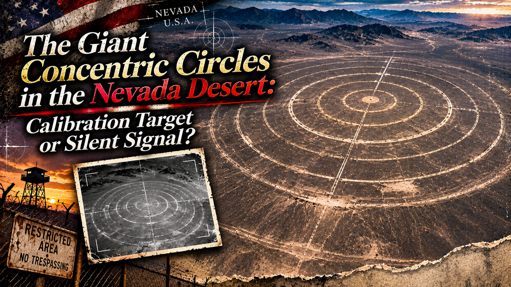
Nevada, USA. Drive north from Las Vegas, and beyond the point where the afterimage of the neon fades, dry land spreads out as if refusing human habitation. Scroll the map and look down on that place, and there it is: a “giant concentric circle” of a precision and coldness that nature could never have produced, stamped into the earth.
In a wilderness cut off from the noise of civilization, it can look like a silent signal fired toward the sky. Judging from the satellite imagery, its diameter appears to reach nearly one kilometer. This giant pattern, formed by scraping the desert surface — or piling earth up — in evenly spaced concentric rings, asserts itself overwhelmingly in the middle of a wilderness where there is nothing else.
Stand at the center of this circle, and a person forgets who they are. What is there is the very pinnacle of inorganic geometry, premised on a “god’s-eye view” looking down on the earth. So for whom was this circle drawn — and to calibrate whose eyes?
Even modern people, used to the view from the sky, stop short before this circle. Perfect geometry, drawn by human hands in a place human hands cannot reach. That contradiction is exactly what sets the imagination of the viewer alight.
Earlier accounts treated this ground drawing as something like “a call to the sky,” and introduced interpretations such as a signal to space, or a hidden device. This time, while preserving those unsettling rumors, we follow them with what the record can support kept separate from what cannot yet be solved.
- Observing the “Ruler on the Ground” on Google Maps
- The Setting — What Is the Tonopah Test Range?
- The “Silent Base” Beneath the Sand
- Why Concentric Circles? — The Technology for Calibrating Cameras in the Sky
- The Eyes of the Cold War — Land Drawn in Order to Be Seen
- Our Reading — A Paradoxical “Eye” Carved into the Earth
- In the Area: Recommended Sights and Activities Around Tonopah
- What to Eat: Food to Enjoy Locally
- Getting There: From Las Vegas — The Road Toward a Wilderness That Refuses Entry
- Fragments Assembled
- Sources & Further Reading
Observing the “Ruler on the Ground” on Google Maps
Open the satellite view at the observation point carried over from earlier accounts. In the very middle of an area of the highest secrecy, where military boundaries cross, perfect circles lie ring upon ring. Zoom in and out repeatedly and follow the concentric shadows the circles cast, and you will understand that this structure is no mere picture, but a giant device with real physical relief.
One thing to keep in mind here: when we look at these concentric circles as “a single mystery,” we must not cut them off from the context around them. Around the circles spread runways, hangars, and control facilities, and the whole functions as part of one giant test range. Before cutting the circles out alone and mystifying them, we first need to know what this land exists for.
The Setting — What Is the Tonopah Test Range?
This place lies within the vast grounds of the Tonopah Test Range, northwest of the famous “Area 51.” Officially, it is a test range administered by Sandia National Laboratories under the U.S. Department of Energy (DOE) and the National Nuclear Security Administration (NNSA).
Its history begins in 1957. Founded by the Sandia Corporation, the range was prepared as an “isolated place” for testing the ballistic characteristics of nuclear weapons and their non-nuclear components for the Atomic Energy Commission. Its area is about 280 square miles. In the midst of the Cold War, it was a calibration room in which humanity turned “vision” and “projection” into weapons.
In the early 1980s, “the Canyons” — rows of white-roofed hangars standing in two lines parallel to the runway — were built, and a unit of F-117 stealth attack aircraft was stationed there for top-secret tactical evaluation. Tests of precision-guided weapons such as JDAM have also been conducted here. In other words, for more than half a century, this land has remained a place for “dropping something from the sky, and watching something from the sky.”
The history of this range also carries a deep shadow of the Cold War. In 1963, plutonium dispersal experiments called Operation Roller Coaster were carried out, and the range was used as a proving ground for confirming the safety of nuclear weapons. IAEA records also preserve radiation surveys of experimental sites such as Clean Slate 1–3 and Double Tracks. A place that measures how weapons “fall” and how they “appear.” Those are the two faces of the land called Tonopah.
1957. Established by the Sandia Corporation as a test range for the Atomic Energy Commission.
Operated by Sandia National Laboratories under the U.S. Department of Energy (DOE) / National Nuclear Security Administration (NNSA).
About 280 square miles. Located about 30 miles southeast of Tonopah, Nevada, at the northwest corner of the Nellis Air Force Range.
Research, development, and flight-test support for the nuclear weapons program. Conducts full-sequence testing of simulated weapons dropped from aircraft.
As the official site puts it, this is a test range “for all national security missions” — and it remains an active facility today. That is exactly why, when we think about what the concentric circles are, the first thing to lay down is not the veil of military secrecy, but the published history of the test range.
The “Silent Base” Beneath the Sand
Around the Tonopah Test Range, there is no end to the many UFO sightings and reports of aircraft making unnatural low-altitude flights. Earlier accounts also recorded dark hypotheses about these concentric circles. We would like to keep these here as “fragments of rumor” that this site has collected.
The rumor that these concentric circles are not a “target,” but the vent of a giant hangar deep underground — or the part of a special electromagnetic-wave device exposed at the surface. According to earlier accounts, it is still whispered among local residents.
The view that the scientific answer — “a calibration target” — is merely a label pasted over a deeper truth lying beneath the sand.
The unsettling question of whether something is buried at the center of the circles — a speculation that earlier accounts posed to their readers.
Behind the birth of such theories lies the human reaction to geometry that is too perfect. Within the natural blankness of the desert, an artificial order has been placed. That gap makes the figure look like a kind of cipher.
But a distinction must be kept. These are rumors that genuinely circulated; they are not confirmed facts. Neither the existence of an underground facility nor the operation of an electromagnetic device is supported by public materials. Savoring a rumor as a rumor, and treating it as fact, are different things.
Why Concentric Circles? — The Technology for Calibrating Cameras in the Sky
Now, let us look at the record on the side that can be confirmed. Examples of giant geometric patterns on the ground, built for “cameras in the sky,” survive at various places across the United States.
According to the CLUI (Center for Land Use Interpretation), known for its surveys of land use, dozens of “aerial photo calibration targets” exist across the United States. Most of them were built in the 1950s and 1960s, and they function like an eye chart at an optometrist’s office. In the “tri-bar” pattern — parallel and vertical bars arranged in some fifteen steps of size — the smallest group of bars that can be resolved indicates the resolution limit of that camera. The prototype is the 1951-model resolution test chart conforming to the military standard MIL-STD-150A.
The largest concentration is the “Photo Resolution Range” at Edwards Air Force Base in California, where 15 targets stand in a straight line across 20 miles — an arrangement that allows several targets to be photographed in a single flight.
Even better known are the giant X-shaped concrete markers, more than 100 of them, placed in the Arizona desert in the 1960s. Precise grids were built in plots 100 feet square, in order to calibrate the cameras of the CORONA reconnaissance satellites developed by the CIA and the Air Force. Seen from the sky, Xs that are almost too perfect in their artificiality stand in ranks upon the land.
To calibrate the resolution, distortion, and focus of the cameras of aircraft and satellites, by comparing a standard pattern on the ground against the photographed result.
Most were built in the 1950s and 1960s, together with the reconnaissance aircraft development of the Cold War. Some are said to still be in use today.
Bar patterns are the mainstream, but circular targets also exist. Whether the Tonopah circles are for calibration cannot be stated with certainty, because no official explanation of their purpose has been published.
This is the important point. The technology of calibration targets is real, and it is natural to place the Tonopah circles within that lineage. However, we could not confirm any official document showing that these particular concentric circles are for calibration. A strong interpretation and an established fact need to be kept apart.
Alongside bar patterns, concentric-circle targets have also been used for the calibration of image measurement. They are, so to speak, a “circular ruler” for examining how lens distortion appears according to the distance from the center of the circle. If the Tonopah circles served that purpose, then the giant circles drawn in the desert were made to adjust the “glasses” of the cameras in the sky.
The Eyes of the Cold War — Land Drawn in Order to Be Seen
In the Cold War era, the cameras of reconnaissance aircraft boasted that they could read a license plate on the ground from extreme altitude. To verify that precision, giant geometric patterns were drawn on the surface of the earth. What was needed, so to speak, was a ruler on the ground — to correct lens aberration, and to measure error even from tens of thousands of feet in the sky.
What is interesting here is the way the gaze circulates. A pattern that may originally have been made to be shown to a machine stirs human imagination, through another machine — reconnaissance satellites and Google Maps. Behind the secretive scenery lies modern imaging technology itself.
Especially symbolic is the “Photo Resolution Range” at Edwards Air Force Base. Fifteen calibration targets stand in a straight line across 20 miles, so that several targets can be photographed in a single flight. According to CLUI records, targets of this kind exist at dozens of sites across the United States, and many of them lie within military restricted areas. The Tonopah circles, too, can be thought of as standing on that same lineage.
Ancient ground drawings and modern calibration targets alike reveal their whole form from the sky. But similarity of appearance does not mean sameness of purpose. The impression of the shapes, and materials that indicate their purpose, must be read separately.
Our Reading — A Paradoxical “Eye” Carved into the Earth
Even if the reason becomes known, the visual impact does not fade. These concentric circles are something like an “eye” made by carving the earth itself, in order to calibrate the “eyes” with which human beings look down on the ground.
It is the largest “period” that the earth has written to the sky. A giant circle in the heat of the desert, read by no one, gazing only at the satellites in the sky above. There lies an inorganic silence, wrapped in the veil of military secrecy.
This grid may be more than a mere measuring instrument. It harbors a strange paradox — as if the earth itself were affirming the fact that the surface of this planet is always “being watched,” and were obligingly arranging things for that purpose. A terrain designed on the premise of being surveilled. When we peer into this place, are we not, through that “eye,” being drawn into the inside of the system ourselves?
Learning what something is, and the disappearance of the strange impression it gives, are not the same thing. The mystery of fact and the mystery of feeling are different things. The former can be checked against materials. The latter is born within the experience and imagination of the person who sees the shape.
No one can stand at the center of the circles. Entry is not permitted; approach is not permitted. That is why these circles remain, forever, “things that belong to the sky.” A device for seeing has been placed on land that refuses to be seen. That twist is what makes the Tonopah concentric circles more than a mere target.
In the Area: Recommended Sights and Activities Around Tonopah
The giant concentric circles themselves are not a place that can be introduced as a sightseeing facility for the general public. On the other hand, the town of Tonopah, which serves as the base, has places where the mining history and desert culture of Nevada can be experienced safely. For an actual trip, plan around facilities that are open to the public.
A facility that conveys the mining history of the town, which began with the discovery of silver ore in 1900. On a tour of the grounds, you can come in touch with how the mining sites of the time appeared.
A museum that covers the history, nature, and Indigenous cultures of the region. It serves as a base for learning about life in the desert and the memory of the mining towns.
A historic hotel founded in 1907. Also known as a hotel where “ghosts appear,” it preserves the atmosphere of the Nevada mining era. For a stay, check the official booking guidance.
The high desert, where town lights are few, is known as an environment suited to observing the starry sky. Do not forget to prepare warm clothing against the drop in temperature at night, and to confirm the safety of the observation spot.
These sightseeing spots and the concentric circles of this article are related within the broad area around Tonopah; they are not neighboring facilities within walking distance. Approaching the test range and visiting sightseeing spots should be planned as separate matters.
What to Eat: Food to Enjoy Locally
If you visit Tonopah, turn your eyes not only to the scenery of the wilderness, but also to the food culture rooted in the mining towns of Nevada. It is a taste grounded in daily life, unlike glamorous resort cooking. The taste of a diner stopped at in the middle of a long drive remains, tied to the memory of the journey. In a small town, the meal itself tells the story of the land.
The hearty breakfasts long cherished at diners along the main highways. A classic of the road, stopped for in the middle of a long drive.
The food culture of Basque immigrants has taken root in Nevada, and meat dishes and homestyle plates tied to the history of sheepherding are known.
At the cafés and restaurants of a small town, simple menus unique to the land can be enjoyed. Business conditions are best checked before visiting.
Because shops’ business conditions, prices, and menus change, we do not list shop names or business hours whose existence cannot be confirmed.
Getting There: From Las Vegas — The Road Toward a Wilderness That Refuses Entry
To approach these circles with the naked eye is almost impossible, because they adjoin one of the most strictly guarded areas of airspace in the United States. But the journey of tracing “how far one can approach” itself becomes part of the story of this place.
From a major international airport in your own country, fly to Las Vegas, and the journey from the city of neon into the wilderness begins. Secure a rental car here. In preparation for the desert drive, fill the tank, and load drinking water as well.
The scenery of the suburbs gradually changes into reddish-brown wilderness. There are stretches where cell phone signal is hard to reach. What spreads outside the window is the magnificence of there being nothing.
A small town in Nevada. While walking a main street that preserves the atmosphere of the mining era, it is good to imagine the “boundary line” of tomorrow.
Ordinary vehicles are stopped here. Beyond the warning signs spreads a world that can be seen only on the map. From here, you can go no farther.
Observing the concentric circles through satellite imagery is the realistic method. Beyond that point, the journey is one you follow on Google Maps and Google Earth.
Do not attempt to cross the boundary of the military test range, to enter areas without permission, to approach facilities, to fly drones, or to take photographs without authorization. Security vehicles patrol near the boundary; follow the instructions on the warning signs.
In the high desert, temperatures vary from over 40°C in summer to below freezing at night. Prepare drinking water, sun protection, warm clothing, and fuel, and avoid driving unpaved roads alone.
Three and a half hours by car from the neon of Las Vegas. As far as the town of Tonopah, anyone can assemble an itinerary. But to see the circles of the satellite photograph from the ground is a separate problem. “A distance that feels reachable” and “a place you may enter” do not coincide. That gap, too, may be one of the reasons this coordinate remains forever strange.
Fragments Assembled
The true nature of the giant concentric circles of Nevada was, in all likelihood, neither a ground drawing by aliens nor the vent of an underground base. The technology of aerial photo calibration, continuing from the 1950s, and the history of a test range in operation since 1957, draw the outline of this place. That is the answer the investigation arrives at.
But after learning that answer, open the satellite imagery once more. The concentric circles may still appear to be trying to convey something, even now. Perfect circles lie in the very middle of the desert, and no one can enter. Is that fact alone not fantastic enough?
On the map, the circles can still be read. Human beings once looked up at the sky and sought meaning in the arrangement of the stars. Now we live in an age in which artificial satellites look down at the ground, and giant patterns are drawn in the desert for their sake. Knowing what something is does not mean losing the mystery. It means that the shape of the mystery changes.
Sources & Further Reading
- Tonopah Test Range — Sandia National Laboratories (Official) — Overview and mission of the test range
- Tonopah Test Range — History (Sandia, Official) — The background of its founding in 1957 and its history
- Sandia LabNews — Sandia’s road to Tonopah Test Range — The test range today and its history
- CLUI — Photo Calibration Targets — An explanation of aerial photo calibration targets
- 99% Invisible — Solve for X — An explanation of the X-shaped calibration markers of CORONA
- Upworthy — Forget Crop Circles… — An introduction to strange patterns on the ground and calibration targets